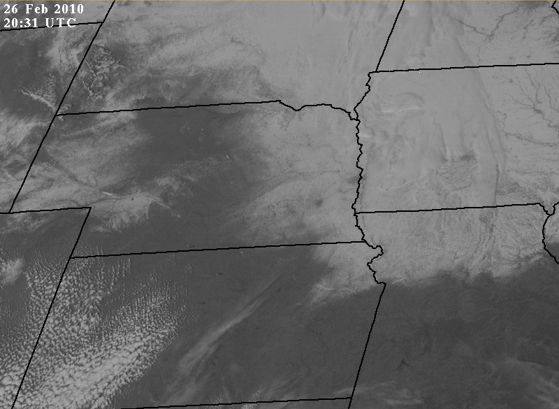
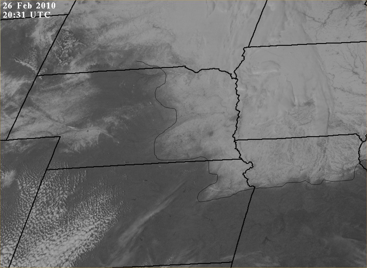
Satellite Image - February 26, 2010
| The first satellite image is from February 26, 2010 at 20:31 UTC or
GMT which is 2:31 PM CST. The second image is the same as the
first except a black line has been drawn to show the western and
southern edge of our snow cover in eastern Nebraska, NE Kansas and
northern Missouri. The urban areas of Lincoln and Omaha are noted by being more gray than the surrounding area due to snow being removed from all of the roads and the buildings having lost all of their snow from their roofs. Ice covered Lake McConaughy can be seen in western Nebraska. There is also a light cover of snow in the panhandle of Nebraska back toward Ogallala. There are also some smooth high clouds that can be seen over central Iowa. A few ice free (dark color) lakes can be seen in north central Kansas along with some puffy cumulus clouds in western Kansas. |
|
School of Natural Resources  |