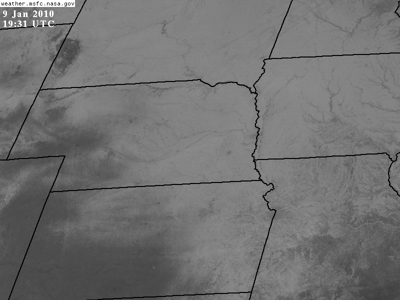
Two Satellite Image Showing Snow Cover on January 9, 2010
An interpretation can be found underneath each of the images
(CLICK HERE for a 3rd Image, the whole U.S.)
| Several things to note: Western/Southwestern Kansas and Western/Southwestern Nebraska do not have a snow cover The snow line runs from the Nebraska Sandhills through Southeast Kansas. River valleys can be seen throughout the snow covered area of Nebraska, Missouri, eastern Kansas and Iowa The Lincoln and Omaha metropolitan areas appear as slightly more gray areas due to exposed roads |
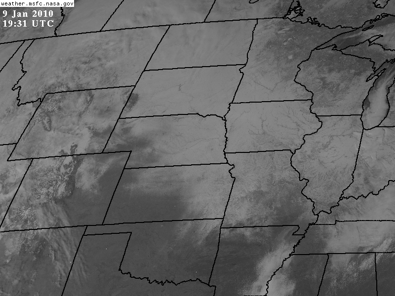
| Several things to note: Western Kansas and Western/Southwestern Nebraska do not have a snow cover The snow line runs from the Nebraska Sandhills through Southeast Kansas into Northeast Oklahoma There is a patch of snow cover in Southeast Arkansas. River valleys can be seen throughout the snow covered area of Nebraska, the Dakotas, Iowa and Minnesota Northeast Minnesota and northern Wisconsin appear dark since the forests hide the snow cover Clouds can be seen across portions of Montana and North Dakota |