
Little Sioux Scout Camp EF3 Tornado...Updated with map and photos
HERE IS SOME UPDATED INFORMATION ON THE LITTLE SIOUX SCOUT CAMP
TORNADO.
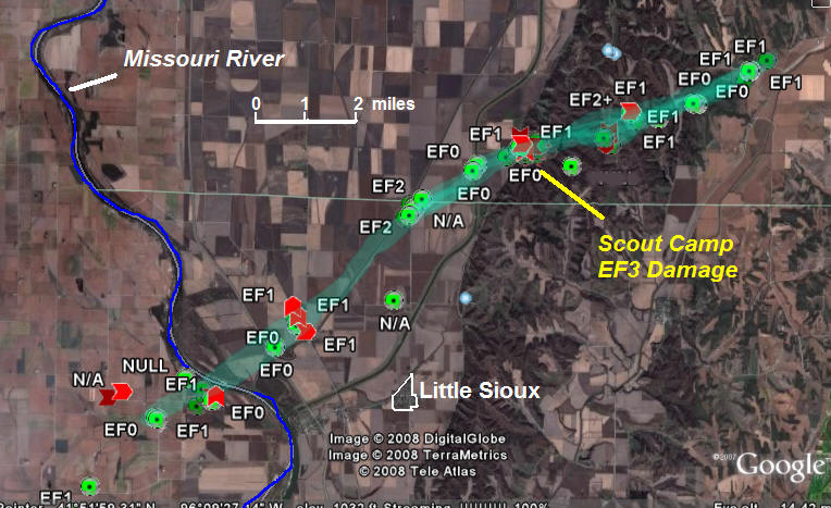
EF3 TORNADO IN BURT...HARRISON AND MONONA COUNTIES
LOCATION...FROM 4.5 MILES WEST OF LITTLE SIOUX IOWA TO 2 MILES
SOUTHWEST OF MOORHEAD IOWA
ESTIMATED TIME...625 PM CDT TO 645 PM CDT
EF-SCALE RATING...EF3
PATH WIDTH...0.25 MILE
PATH LENGTH...AROUND 14 MILES
THE TORNADO STARTED 4.5 MILES WEST OF LITTLE SIOUX IOWA IN BURT
COUNTY WHERE CENTER PIVOT IRRIGATION SYSTEMS WERE TIPPED OVER AND
TREES SUSTAINED DAMAGE. THE STORM TRACKED NORTHEAST ACROSS THE
MISSOURI RIVER AND INTERSTATE 29 NEAR MILE MARKER 97. THIS IS WHERE
A SEMI-TRUCK FLIPPED ON ITS SIDE. HEADING NORTHEAST...THE TWISTER
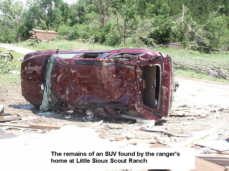
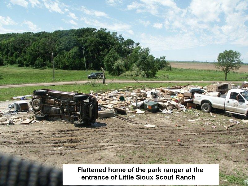
SNAPPED POWER POLES AND THEN ENTERED THE LITTLE SIOUX SCOUT RANCH.
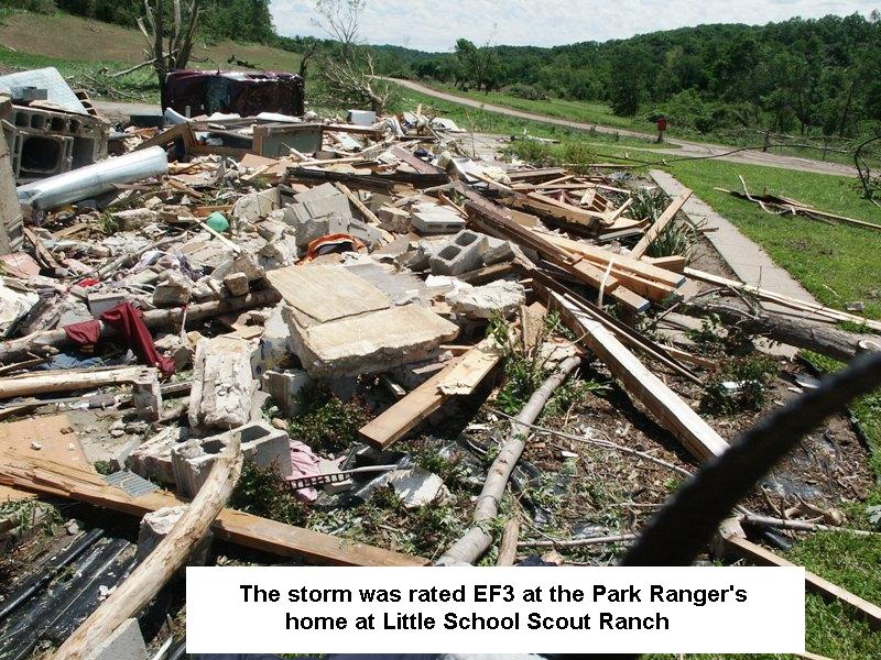
THE TORNADO DESTROYED THE RANGERS HOME NEAR THE ENTRANCE OF THE PARK
AND WAS RATED A SOLID EF-3. THE STORM THEN BLEW DOWN TREES AND
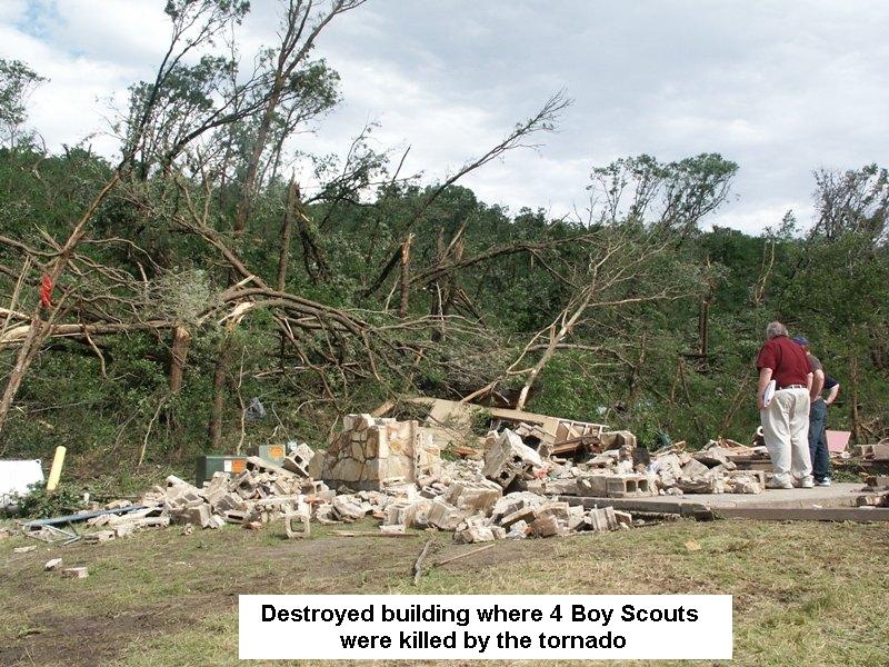
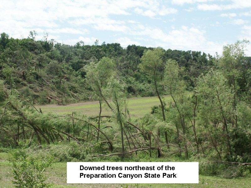
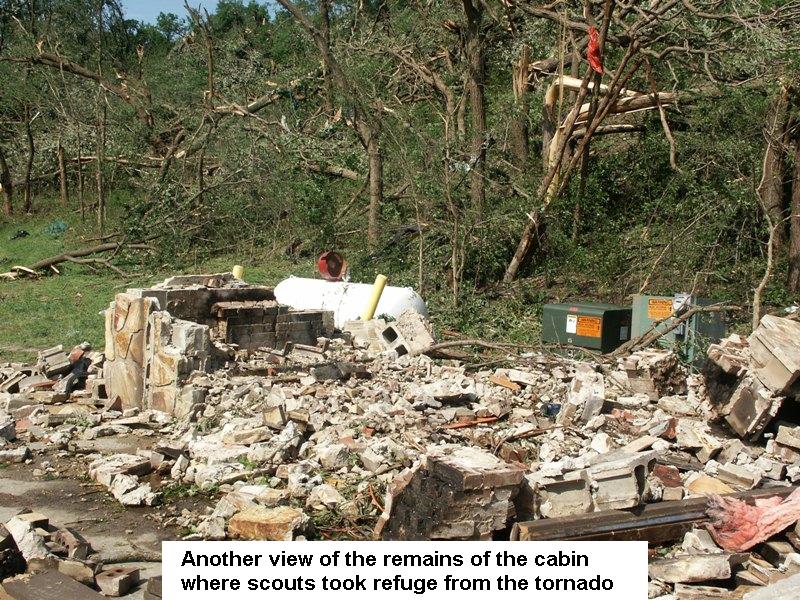
STRUCK THE BUNK HOUSE WHERE THE FOUR FATALITIES OCCURRED. THE STORM
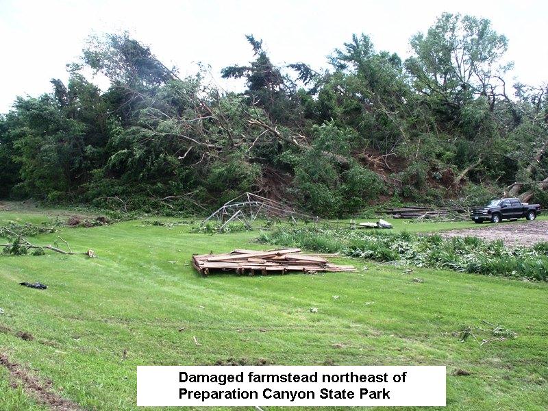
CONTINUED NORTHEAST INTO PREPARATION CANYON STATE PARK AND CONTINUED
TO TOPPLE TREES. PRIOR TO ENTERING THE PARK...A FARMSTEAD SUSTAINED
DAMAGE. THE TORNADO THEN HIT ANOTHER FARMSTEAD APPROXIMATELY 2.5
MILES SOUTHWEST OF MOORHEAD. TREES WERE BLOWN DOWN AND SHEDS WERE
DAMAGED ON THE FARMSTEAD. THE TORNADO THEN BEGAN TO WEAKEN AND
LIFTED 2 MILES SOUTHWEST OF MOORHEAD.
THE TORNADO RESULTED IN 48 CONFIRMED INJURIES AND 4 FATALITIES.
ENHANCED FUJITA SCALE
EF0...65 TO 85 MPH
EF1...86 TO 110 MPH
EF2...111 TO 135 MPH
EF3...136 TO 165 MPH
EF4...166 TO 200 MPH
EF5...201+ MPH
Below is a single radar image from around 633 pm showing the circulation
that produced the tornado as it moved near and through the Little Sioux Boy
Scout camp between Little Sioux and Blencoe Iowa.

Below is an animated image showing the progression of the circulation couplet, from when the tornado warning was issued at 624 pm, through around 642 pm when radar data became unavailable due to a lightning strike directly at the NWS office in Valley. A small red square is shown depicting the mostly likely tornado location in each frame. The tornado warning polygon is also outlined in red.

Below is an animated image showing the progression of the WSR88D base reflectivity, from when the tornado warning was issued at 624 pm, through around 642 pm when radar data became unavailable. A small red square is shown depicting the mostly likely tornado location in each frame. This appeared to be a hybrid type supercell storm and not a classic supercell with a pronounced hook echo. Also note, the tornado was likely wrapped in rain and may have been very hard to see.
