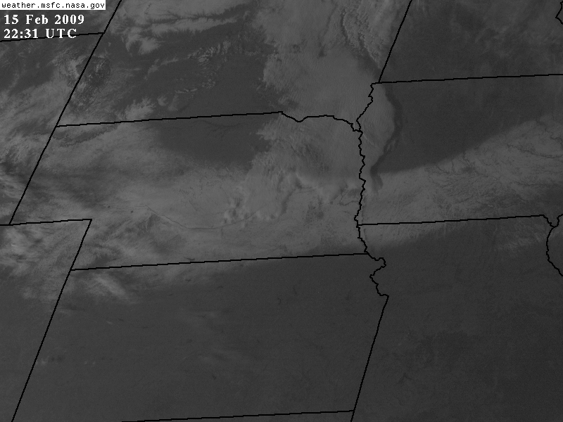
Just before sunset, the clouds in northeastern Nebraska can more easily be seen in this image. Also note the shadow cast by the clouds in western Iowa.
Satellite Image, February 15, 2009 Showing Snow Cover from the February 13, 2009 Snowfall
|
|
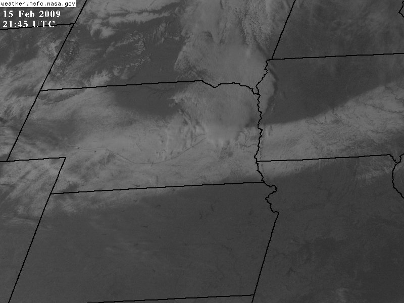
| The southern and northern edge of the snow cover can be
clearly seen on this image. Note that there are some clouds in
Northeast Nebraska hiding the view of the surface snow. The same
image is shown below with red lines marking the edge of the snow cover . |
|
|
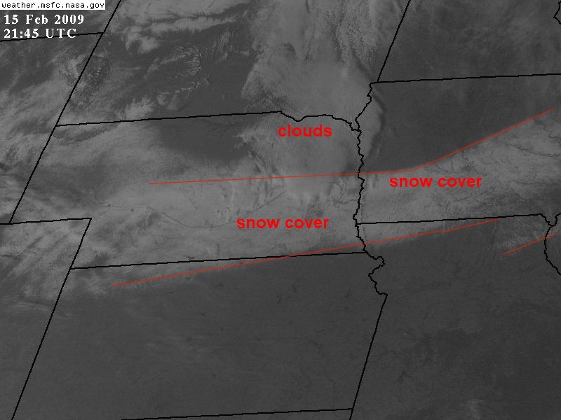
| The red line in the above image indicates where the northern and southern edge of the snow cover is located. If you look closely you can also see the Platte River and several reservoirs both in the snow covered and non snow covered areas. |
|
Just before sunset, the clouds in northeastern Nebraska can more easily be seen in this image. Also note the shadow cast by the clouds in western Iowa. |