FEBRUARY 2009
LINCOLN, NE

February 6, 2009: Photo © K. Dewey, Applied Climate Sciences,
School of Natural Resources, University of Nebraska, Lincoln. 
A night time view of the Lincoln, NE city Center from Hardin Hall, home of this Web Site.
Also see our photo gallery
    
ANNOUNCEMENT:

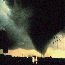
Saturday April 4, 2009


The Central Plains Severe Weather Symposium
and family Weatherfest. 


CPSWS and Weatherfest 2009 Event Website:  Click Here


Photos from last year:
 CPSWS2008 and Weatherfest Photo Gallery

Monthly Snowfall 2008-09

Month
Oct.
Nov.
Dec.
Jan.
Feb.
Mar.
Apr.
TOTAL
Observed
0.0
T
5.5
5.6
8.1
   
19.2
Normal
0.7
3.1
5.4
6.1
5.4
5.1
1.7
27.5
 
February 27-28, 2009 Eastern Nebraska Snowfall
Snow Geese Migrating across Nebraska
Arizona Scenery January 2009 Trip  
Satellite image Showing Snow Cover from the February 13, 2009 Snowfall
February 13, 2009 Eastern Nebraska Snowfall
February 6, 2009:  Spring Like 70's and 80's Surge across the Region
January 2009 Temperature Graph
February 1, 2008 - January 31, 2009 Temperature Graph
Lincoln Cold Waves 1887-2009
Nebraska Winter Weather Forecast Page
 Lincoln Live Weather Watching Web Cams
  Lincoln Cold Waves 

January 22, 2009 Warmth across the Midlands

New Record High on February 6, 2009 of 65 F, old record was 60 set in 1966
New Record Warm nighttime minimum of 42 F on February 9, 2009. The old record warm minimum was 40 set in 1953.
LINK: February Record Book

FEB. 2009
 
MAX
MIN
MEAN
DEP
PREC
REC
PREC 
REC
MAX 
REC
MIN 
HDD
CDD
Norm
MAX
Norm
MIN
Norm
MEAN
SNOW
Sunday
Feb. 1
45
18
32
+8
0.01
0.45
64
-24
33
0
35
13
24
0.1
Monday
Feb. 2
43
10
27
+3
0.00
1.12
68
-22
38
0
35
13
24
  
Tuesday
Feb. 3
22
6
14
-11
0.00
0.73
68
-22
51
0
36
14
25
  
Wednesday
Feb. 4
36
5
21
-4
0.00
0.47
67
-21
44
0
36
14
25
 
Thursday
Feb. 5
59
18
39
+14
0.00
0.38
67
-20
26
0
36
14
25
 
Friday
Feb. 6 65 19 42 +16 0.00
0.87
65
-17
23
0
36
15
26
 
Saturday
Feb. 7
62
27
45
+19
0.00
0.28
71
-18
20
0
37
15
26
 
Sunday
Feb. 8
43
22
33
+7
0.00
0.91
71
-19
32
0
37
15
26
 
Monday
Feb. 9
59
42
51
+25
0.11
0.80
68
-24
14
0
37
15
26
 
Tuesday
Feb. 10
63
35
49
+22
0.00
0.65
75
-16
16
0
38
16
27
 
Wednesday
Feb. 11
48
25
37
+10
0.00
1.55
75
-26
28
0
38
16
27
 
Thursday
Feb. 12
48
20
34
+7
0.00
2.20
73
-24
31
0
38
16
27
 
Friday
Feb. 13
32
12
22
-6
0.36
1.36
69
-26
43
0
39
17
28
4.0
Saturday
Feb. 14
26
1
14
-14
0.00
0.79
75
-15
51
0
39
17
28
 
Sunday
Feb. 15
33
18
26
-2
T
0.45
74
-11
39
0
39
17
28
T
Monday
Feb. 16
44
16
30
+1
0.00
0.73
69
-18
35
0
40
18
29
 
Tuesday
Feb. 17
57
29
43
+14
0.00
0.50
72
-19
22
0
40
18
29
 
Wednesday
Feb. 18
37
19
28
-1
0.00
0.84
70
-17
37
0
40
18
29
 
Thursday
Feb. 19
41
11
26
-4
0.00
0.50
71
-15
39
0
41
18
30
 
Friday
Feb. 20
53
20
37
+7
0.00
1.36
71
-10
28
0
41
19
30
 
Saturday
Feb. 21
32
13
23
-7
0.00
1.31
74
-9
42
0
41
19
30
 
Sunday
Feb. 22
36
11
24
-7
0.00
1.57
74
-10
41
0
42
20
31
 
Monday
Feb. 23
45
17
31
0
0.00
0.65
75
-16
34
0
42
20
31
 
Tuesday
Feb. 24
61
30
46
+15
0.00
0.82
72
-9
19
0
43
20
31
 
Wednesday
Feb. 25
60
30
45
+13
0.00
1.12
77
-8
20
0
43
21
32
 
Thursday
Feb. 26
47
15
31
-1
T
0.68
79
-9
34
0
43
21
32
  
Friday
Feb. 27
25
11
18
-15
0.06
1.92
74
-10
47
0
44
21
33
1.0 
Saturday
Feb. 28
19
2
11
-22
0.10
1.71
78
-12
54
0
44
22
33
3.0 
TOTAL


0.64


941


8.1
AVERAGE
  44.3 17.9 31.1


NORMAL
 
39.3
17.2
28.3
 
0.66


1043


5.7
DEPARTURE
  +5.0 +0.7 +2.8   -0.02       -102         +3.4
 
Lincoln's Snowfall Climatology:
Date of the First Snowfall Each Autumn/Winter 1948-2008 Ranked
Date of the First Autumn/Winter) Snowfall each Year  1948-2008 Listing by year
Length of the Snow free Season, 1948-2008 Graph
Monthly and Annual Snowfall 1887-to present (listed by year)
Monthly and Annual Snowfall 1887-to present (listed by Season)
 Lincoln Seasonal Snowfalls Ranked
Lincoln Snowfall Statistics
Which month is normally the snowiest for Lincoln?
 

From the record books:

Warmest recorded FEBRUARY temperature,
Leap Years:  83 F, February 29, 1972.
Non-Leap Years:  79 F, Feb. 26, 1896 and Feb. 28, 1972.

Coldest recorded FEBRUARY  temperature, -26 F,  Feb. 11, 1899 & Feb. 13, 1905.
Most FEBRUARY Snowfall: 26.1 inches, 1965.
Least February Snowfall: none measurable, 5 of the last 110 years 
(1922, 1946, 1977, 1991 & 1996).

AVERAGE AND TOTAL are FEBRUARY 2009.
NORMAL (Norm) is the 1971-2000 Standard Normals.
DEPARTURE is FEBRUARY 2009 Average measured against 1971-2000 normals.
MAX = Observed Maximum and MIN = Observed Minimum temperatures.
MEAN = Observed Mean Daily temperature.
DEP = Departure from normal ( __ = below normal, + above normal).
PREC = Observed daily precipitation (midnight to midnight, CST).
REC PREC = Record daily precipitation amount in inches. 
REC MAX = Record maximum temperature.
REC MIN = Record Minimum temperature. 
HDD = heating degree day units (base of 65 degrees).
CDD = cooling degree day units (base of 65 degrees).
Norm MAX = Daily Normal High Temperature (1971-2000 normals).
Norm MIN = Daily Normal Low Temperature (1971-2000 normals).
Norm MEAN = Daily Normal Mean Temperature (1971-2000 normals).
SNOW = Snowfall in inches